Geo4nonpro's lockdown geolocation challange - week 1, image 1
Geo4nonpro ran a geolocation challenge for those of us housebound by coronavirus. For my own records and the possible interest of others, I wrote down some of my approaches to solving the challenges posted.

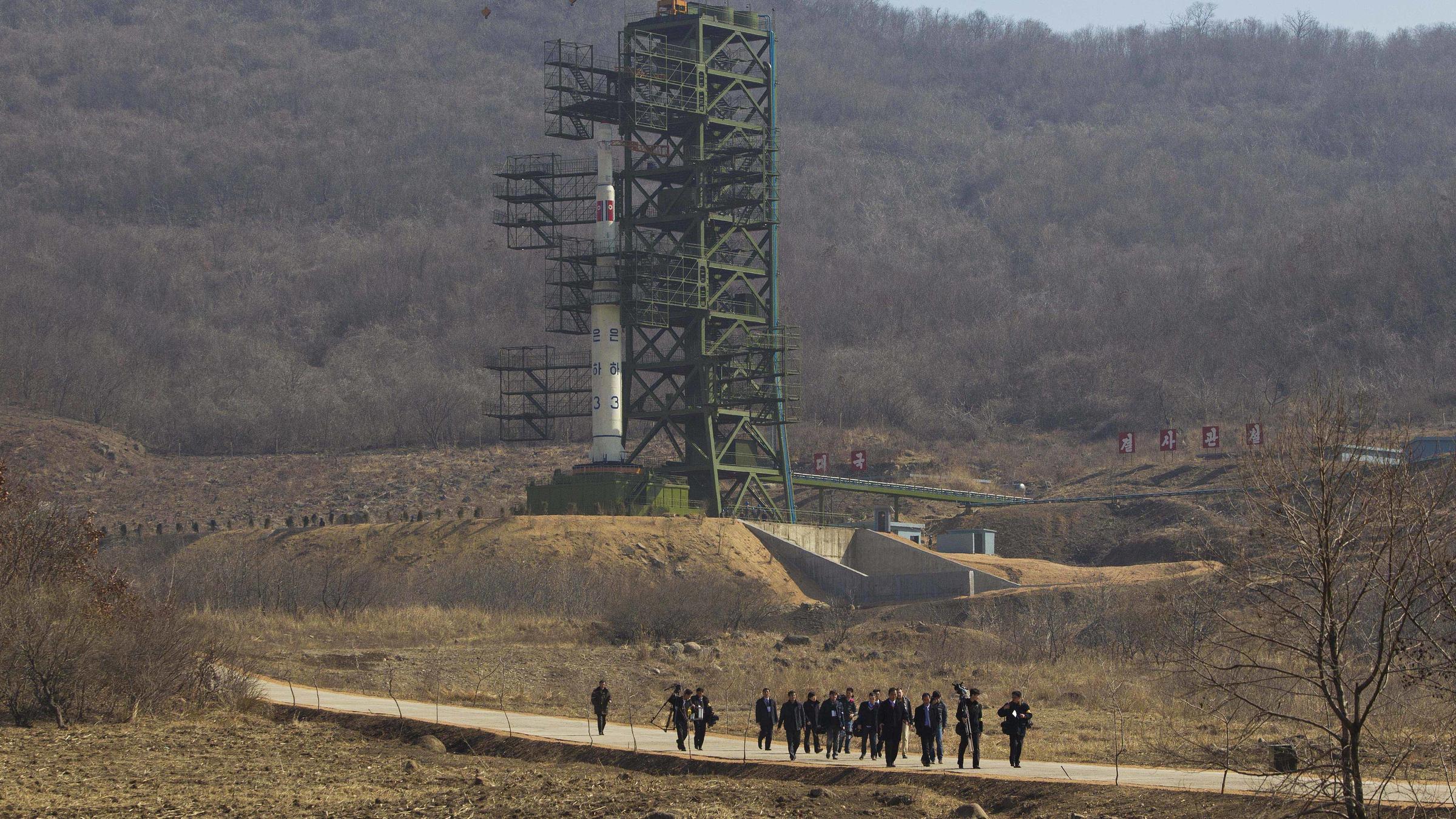
The first image shows a group of people walking along a road in front of a rocket or missile on a launchpad. There is Korean script on the rocket and the top section is decorated with DPRK flags: this might be enough to suggest an Unha launch from the Sohae space launch centre to some of you, but if not let’s look to Yandex reverse image search for some more information:

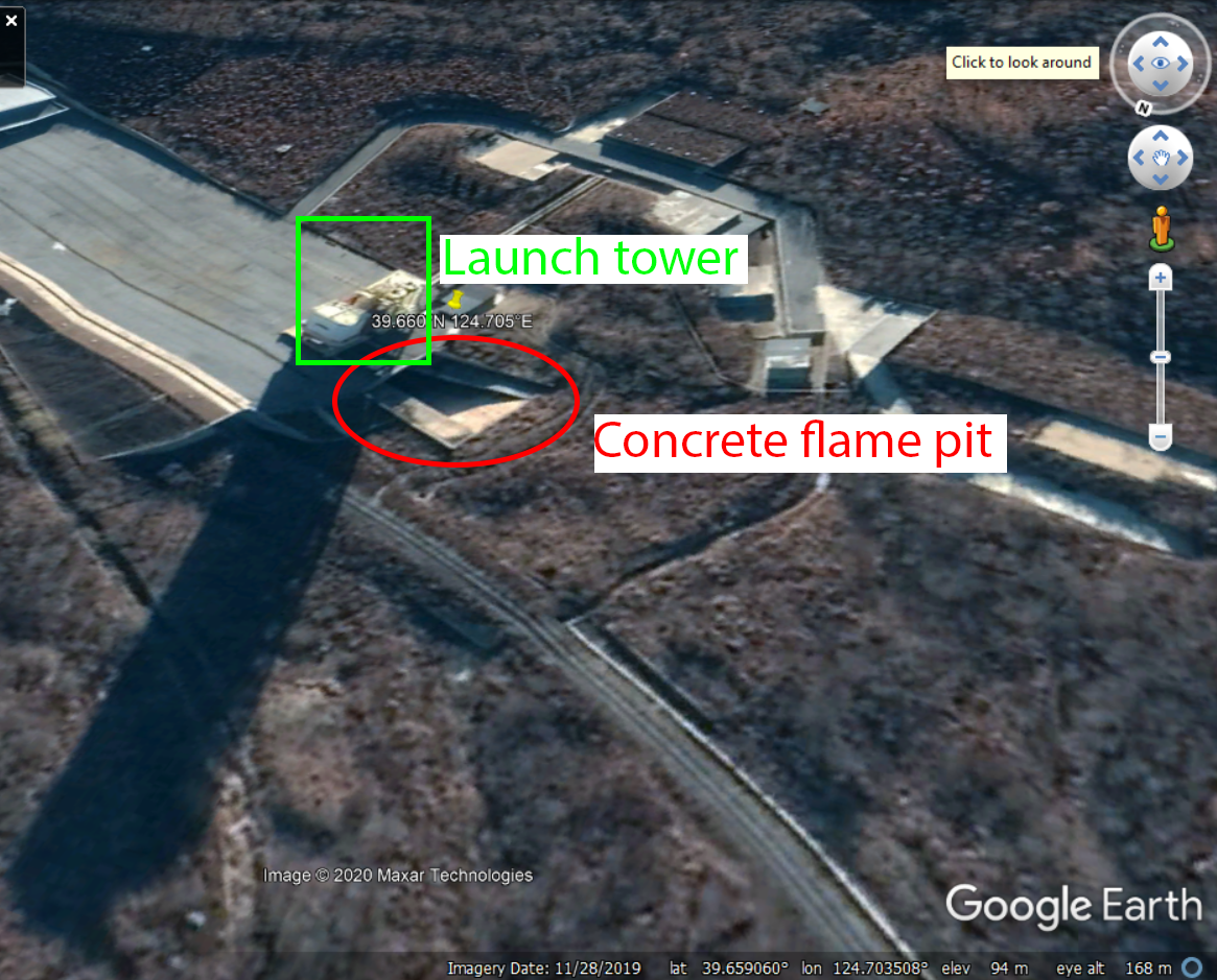
Yandex does a great job here, and quickly tells us that this is a picture of the Sohae launch centre. The Wikipedia article for Sohae gives us coordinates of 39.660°N 124.705°E for the site, so with that it’s off to Google Earth for some more precise geolocation of the site. The coordinates from Wiki articles aren’t always perfect, but in this case it drops us right on top of the launch tower.
Rough orientation in Google Earth
There are two key features immediately visible: a tall launch tower (see how long the shadow is!), and a recessed concrete flame pit structure to redirect the exhaust of the rocket. The concrete flame pit gives the rough location of the photograph: to the North of the launch pad, looking South towards it.

Using sight lines to narrow down the location
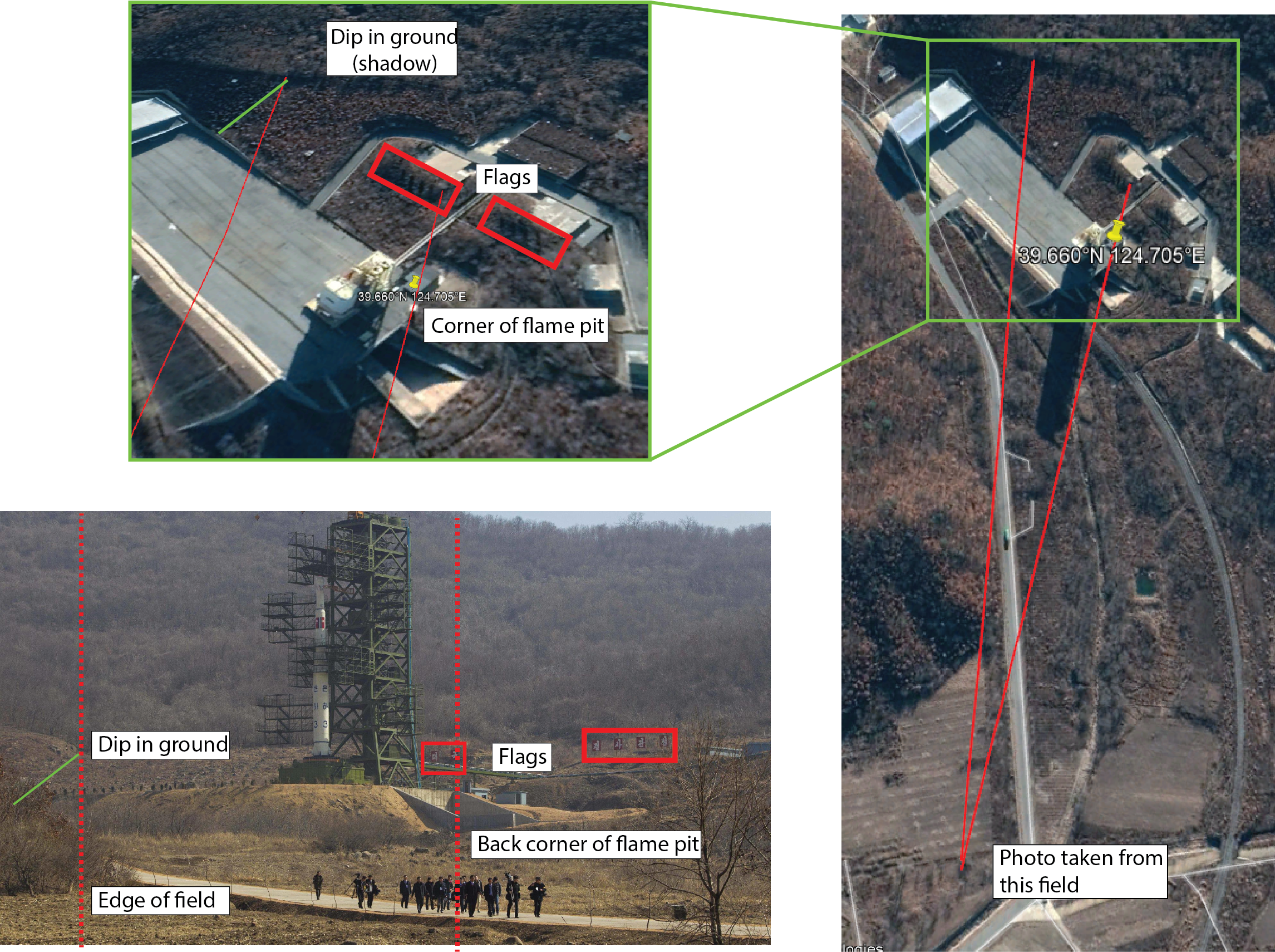
With a rough direction, the next step is to more precisely locate where the photograph was taken from. To do this I looked to take sight lines from vertically aligned objects in the photograph that would be identifiable from satellite imagery. There isn’t a great deal to work with in this picture, but one nicely aligned set of features contains the rightmost large Korean character flag/sign of the left group, the back corner of the concrete flame pit, and the front wall of the flame pit where the angled top becomes flat. All three of these features are visible in Google’s imagery, allowing us to project a line past the road (ahah!) and into a field that looks similar to that seen in the photograph.
To triangulate location more accurately, I took a second line from where a dip in the ground (green line, below) behind the launchpad meets the treeline, and drew this down to the corner of the field where in meets the road. Projecting a line through these two points suggests that the photo was taken from near the front of the field (below).

Tightening the location with an estimation of distance
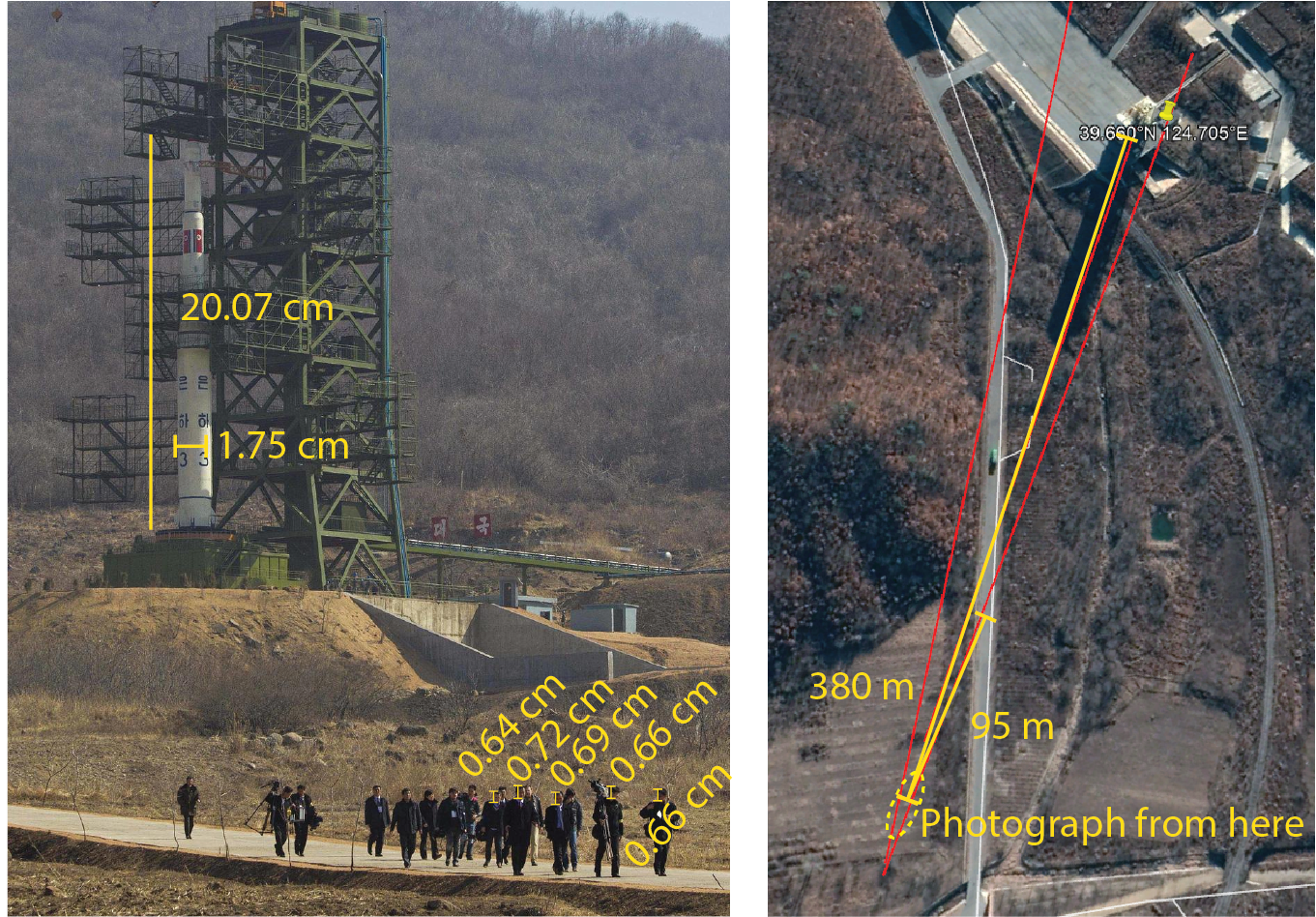
As a final check, I tried to estimate the distance of the photographer by mensuration. Using Illustrator’s measurements, the Unha SLV on the launchpad appears to be 1.75 cm wide and 20.07 cm high in this photograph. Picking five of the men in the front of the group on the road and measuring the heights of their heads give 0.64, 0.72, 0.69, 0.66, and 0.66 cm for an average of 0.67 cm.
Wikipedia suggests that the Unha SLV has a diameter of 2.4 m and a height of 28 m, giving 137x and 139x magnification for the SLV. The height of an average male human head is 23 cm, giving a magnification of 34.3x for our pedestrians. Dividing 138 by 34.3 tells us that the SLV is 4.0x times as far from the camera as the walking group are. Drawing some lines between the estimated position of the people on the road and the launch tower narrows the photographer’s location to about 380 m from the Unha SLV and 95 m away from the people on the road.

The location obtained by mensuration (above, yellow lines) is close to the (less precise) intersection of sightlines (above, red lines). I’ve drawn a guessed uncertainty ellipse on the map in dashed yellow: from the agreement between the data shown here, I think that the location of the photographer is accurate to within 5-10 m. Not bad at all!