Geo4nonpro's lockdown geolocation challange - week 1, image 2
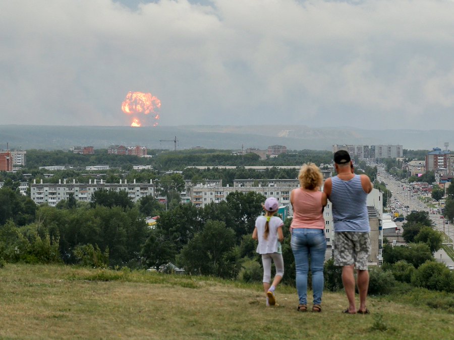
The second image is perhaps the hardest of the set to geolocate. This image depicts a group of three people standing on a hill and looking at an enormous explosion some distance away:

Reverse image search
As usual, step 1 is to plug this picture into a Yandex reverse image search. There are plenty of hits of this exact picture, and clicking through to one of the many news stories reveals that the people are in the town of Achinsk watching a series of explosions from a nearby ammunition depot on August 5, 2019. A little more searching turned up a blogpost geolocating the image, but that ruins the fun so we’ll carry on.
Locating the site of the explosion
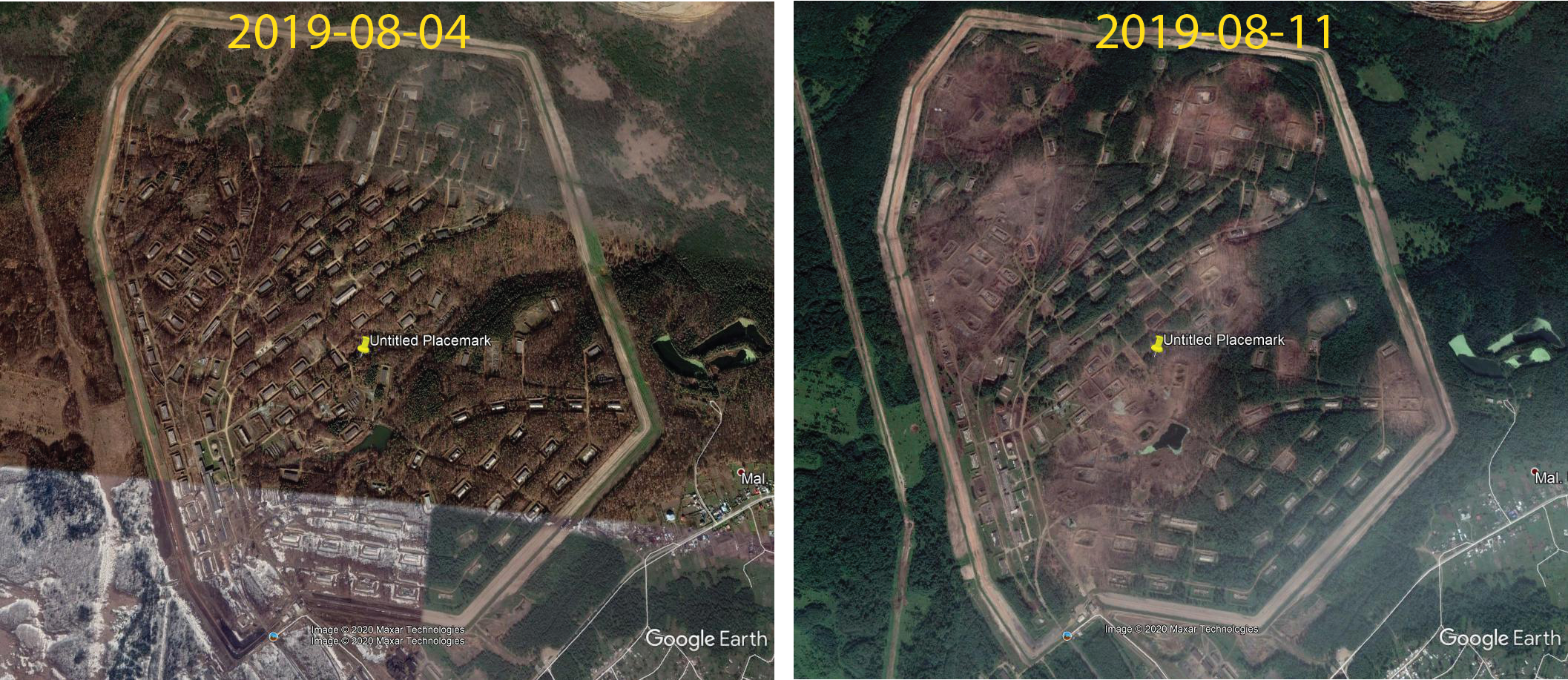
A number of articles mention that the explosions occurred around 10km from Achinsk. Achinsk is isolated enough that there are only a few features on Google Earth that sit ~10 km out. One is a military installation located at 56.170033, 90.402591 that Wikimapia identifies as the 60th Combat Engineers Regiment. Seems promising! We know that the blast occured on the 5th of August, so let’s use Google Earth’s historical imagery to see if the site changed in imagery taken before and after that date:

With blast damage all over the site and many buildings destroyed, this looks to be the source of the explosion.
But where in Achinsk are the viewers?
We now have the location of the explosion: about 10 km southwest of Achinsk. As the photo seems to be taken from a hill overlooking Achinsk, we can now say that the onlookers are going to be roughly northeast of Achinsk looking southwest. The large street visible to the right of the people looks like a major road, and should be useful to get a better idea of where the people are standing.
Looking back at Wikimapia, the main road running northeast-southwest through Achinsk looks to be Ulitsa Kravchenko. Taking a (virtual) drive down Ul. Kravchenko in Google Streetview quickly confirms that this is indeed the correct location, with the distinctive blue-roofed apartments sitting at the corner of Ul. Kravchenko and Ul. Zvereva.

Locating the people on the hill
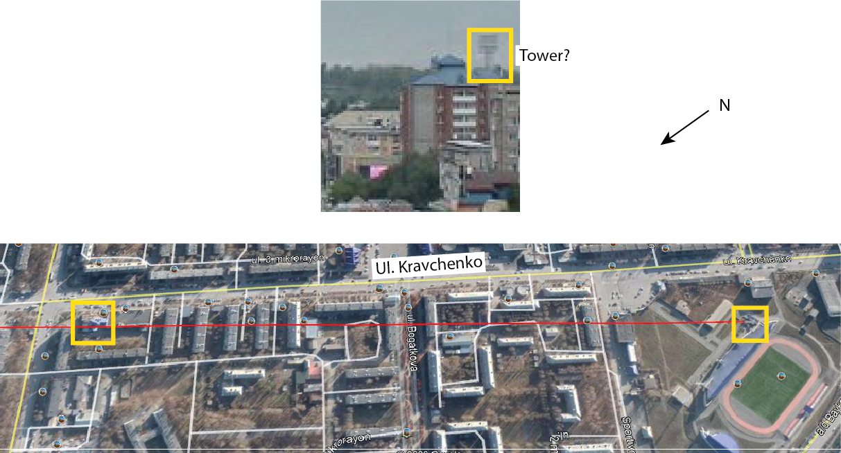
We now know the people are on a hill slightly to the south of Ul. Kravchenko, looking southwest. Looking more carefully at the image, there seems to be tower of some sort jutting out above the blue roof of the apartment building. There’s a stadium about 1 km past the apartments in that direction, and by picking a Google Earth image from a sunny day it’s possible to see the long shadows of a tall lighting tower. Projecting a line from the lighting tower over the south edge of the apartments should lead us right to the photographer.

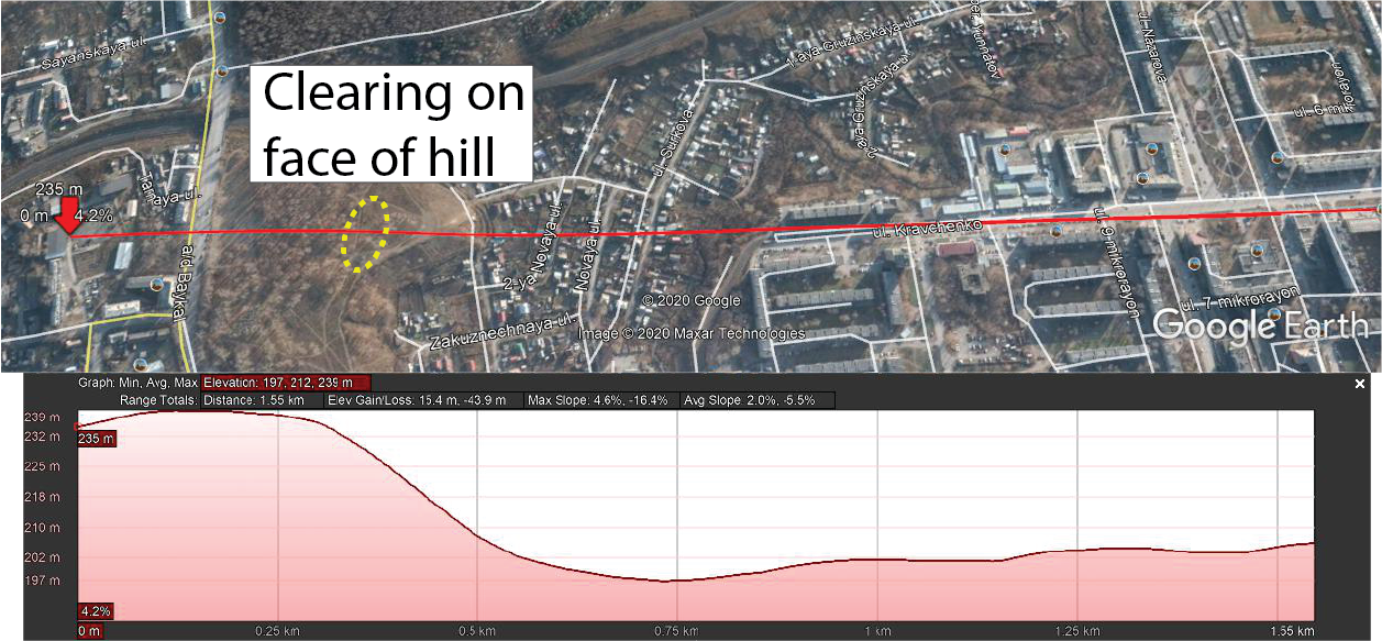
Following the line from the lighting tower over the apartments leads past the end of Ul. Kravchenko and over a few streets of low suburban houses. After that comes a forested area on the side of a hill. The people in the photograph seem to be well above the city of Achinsk, and so it seems reasonable to expect that they might have climbed to the top of the hill to watch the fireworks. Google Earth can calculate the elevation over a drawn line, and we can use this tool to work out where the top of the hill is and locate the group of people.

The projected line passes through the houses before encountering a fairly steep hill, initially as a tree-covered face. Following the elevation profile leads us straight to a clearing near the top of the hill but before it flattens, matching the location shown in the initial photograph.