Geo4nonpro's lockdown geolocation challange - week 2, image 1
The second set of geolocation challenges arrived, featuring 10 new images to place. As with week 1, these range in difficulty with some much easier to place than others. Image #1, however, took me more than twice as long to locate as did the other 9 images combined.

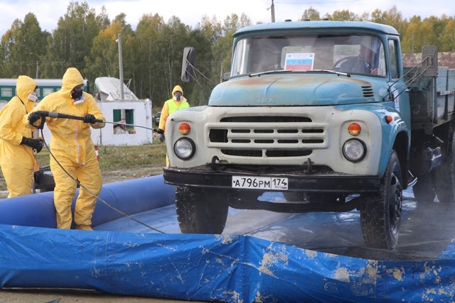
This image features a truck being decontaminated by people in protective clothing, suggesting a chemical or radiological accident or training scenario. There’s a weirdly half-built prefab concrete building in the background, and behind it is what looks like a derailed passenger train. This confused me in a way that with hindsight should have raised more alarm bells: why would a passenger train accident release a chemical/radiological hazard?
Yandex doesn’t return a direct match for the image, so we’re off to a slightly challenging start. It does inform us that the truck is a ZIL-130… which Russia has produced literally millions of, so that’s not much help either. The license plate, however might provide us with some useful information. Wikipedia’s article on registration plates in Russia informs us that the “A” prefix means that this is a government vehicle (unsurprising), and the “174” suffix means that it’s registered in Chelyabinsk. Chelyabinsk immediately brings to mind the Mayak plutonium plant, based in the city of Ozersk, but with millions living and working in Chelyabinsk Oblast Mayak isn’t the only possibility. At this point I spent an hour on Yandex trying to lookup the owner of the vehicle license plate and find out which government department owned this vehicle, but to no luck. I also discovered that Russian number plates are filled consecutively for each A-xxx-BC series, so tried to look up some other A-xxx-PM 174 plates in the hope of identifying other ZIL-130 trucks perhaps registered together. No luck.
At this point I wasn’t sure if the photo was of a real accident or a training scenario, so I spent some time searching Yandex for terms relating to Chelyabinsk, Ozersk, Mayak, Snezhinsk and train chemical accident or train nuclear accident. I found a lot of info on a bad bromine spill in Chelyabinsk a few years back, but nothing that looked consistent with this photo. I concluded that this is probably a training scenario: the passenger train derailment doesn’t really fit with a radiological accident, and the building looks like a prefab stand-in of the sort that might be put up quickly for an exercise.

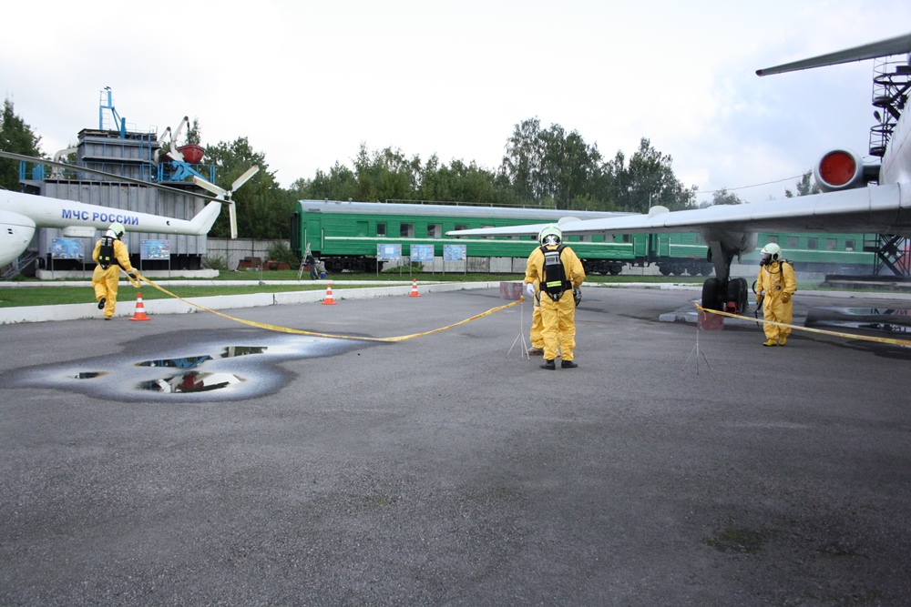
I then started searching for terms related to “radiological accident training exercise Chelyabinsk” in Yandex. After a little searching I was able to find this article on the NW Atom (АТЦ Росатом) website. It’s discussing a training scenario in St Petersburg, not Chelyabinsk, but the general vibe is pretty similar to the target photograph. What is NW Atom, exactly? It turns out to be the Rostaom sub-organisation responsible for emergency response, which sounds like the sort of group that might be running the exercise we’re looking for. A little research told me that АТЦ Росатом has emergency response teams stationed across Russia, but none in Chelyabinsk: the nearest ones are in Glazovsky, to the West, and Seversk to the East. Both locations are over 1000km from Chelyabinsk, which seems a little far to go for a training exercise but maybe plausible.
The NW Atom website has a press centre section reporting on their activities. I decided to look through it for any exercises involving the Seversk or Glazovsky branches of the organisation. It seems that in 2019, the Seversk branch ran an exercise in Chelyabinsk called “Ural 2019”. I wasn’t wrong about the distances being big: apparently the response crew covered 3960 km between the 19th of September and the 2nd of October. The press release didn’t really include any useful photographs, but this sounds like it may be what we’re looking for.
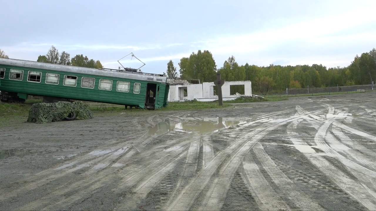
Searching Yandex for the description of the exercise in the title of the press release, участие в тактико-спасательных учениях “Урал-2019”, turned up a video report on Youtube. I used WeVerify’s Invid Toolbar to split the video into keyframes, and it’s clear that we’ve found the right place: we can identify the ZIL-130 truck by its registration plate, and gain some different angle shots of the derailed train.


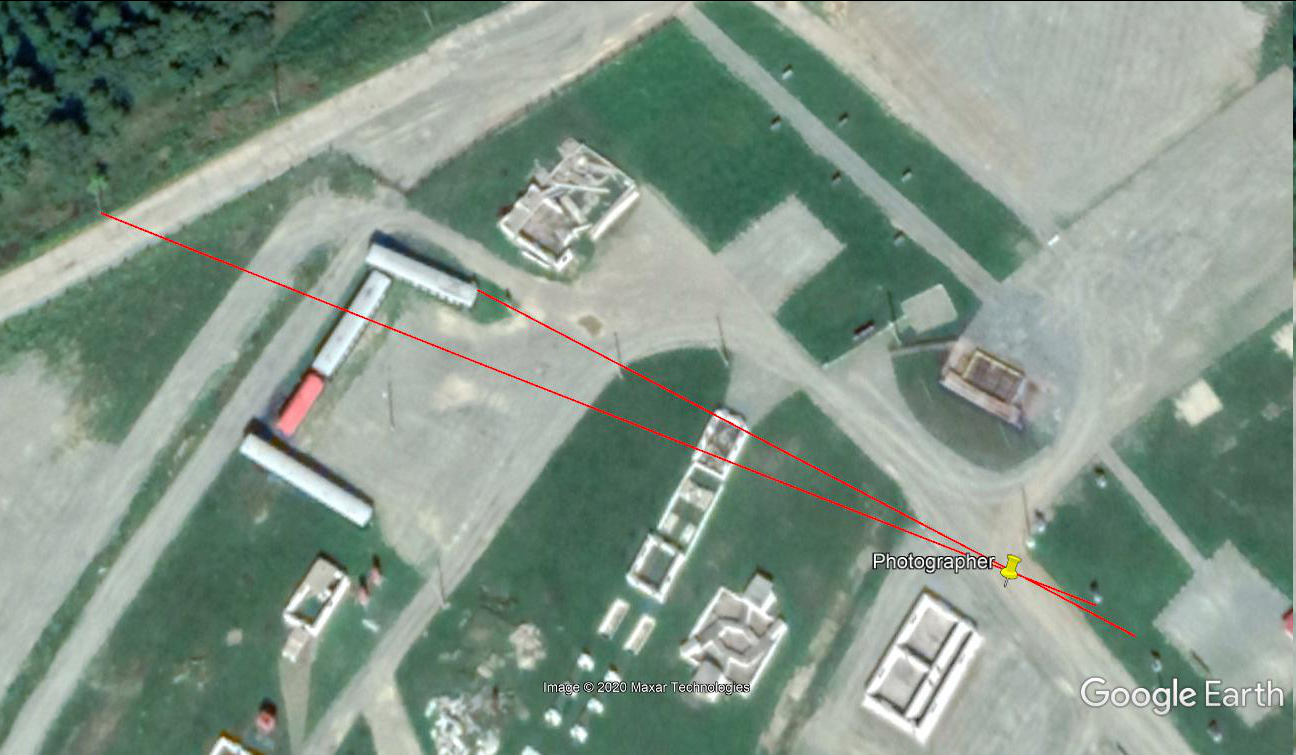
However, we still don’t know where the article took place. A little more searching led me to this article which informs us that the exercise occured in the town of Novogornyy, between Chelyabinsk and the Mayak plant. At this point I spend some time looking at all the railways in and near Novogornyy for a flat gravelled area, but couldn’t find any and so returned to re-read the article more carefully. The atomic-energy.ru article linked above tells us that the exercise occurred “На полигон учебно-спасательного центра МЧС РФ”, or at the training grounds of the RF Ministry for Emergencies. Looking at Wikimapia for Novogornyy, this is labelled as a site to the northeast of the town. The site doesn’t have a rail link: the rails in the photograph are clearly only a short section for training purposes. Casting around the site for a large bright red object reveals the train carriages at 55.638486°, 60.802021°, and by sighting the “derailed” carriage over the end of the fake building and the power pole behind the 3rd window of the carriage on the track we’re able to locate the photographer at 55.638426°, 60.803911°.

This took me several hours of work to get through, but felt extremely satisfying: with no single result for the original image, putting together the pieces that eventually led to Novogornyy felt like a proper open-source investigation. Everything was great until one of the other geolocators pointed out that a simple Google reverse image search led to the exact page the photograph came from, buried right at the bottom of the page under a useless pile of pictures of jumping castles and non-Russian blue trucks (I never did find the original photograph online). If I’d noticed this, the search would probably have taken me a tenth as much time as it did in the end. Ah well, I still feel pretty good for locating my first image without being able to identify the exact source it came from.
