Geo4nonpro's lockdown geolocation challange - week 2, image 2
The second set of geolocation challenges arrived, featuring 10 new images to place. As with week 1, these range in difficulty with some much easier to place than others. Image #1, however, took me more than twice as long to locate as did the other 9 images combined.

The picture shows cooling towers located behind a long industrial building with railway line entering the main doors. The cooling towers suggest a power plant, which in this context likely means a nuclear power plant. The dismal setting and featureless landscape suggests Russia.
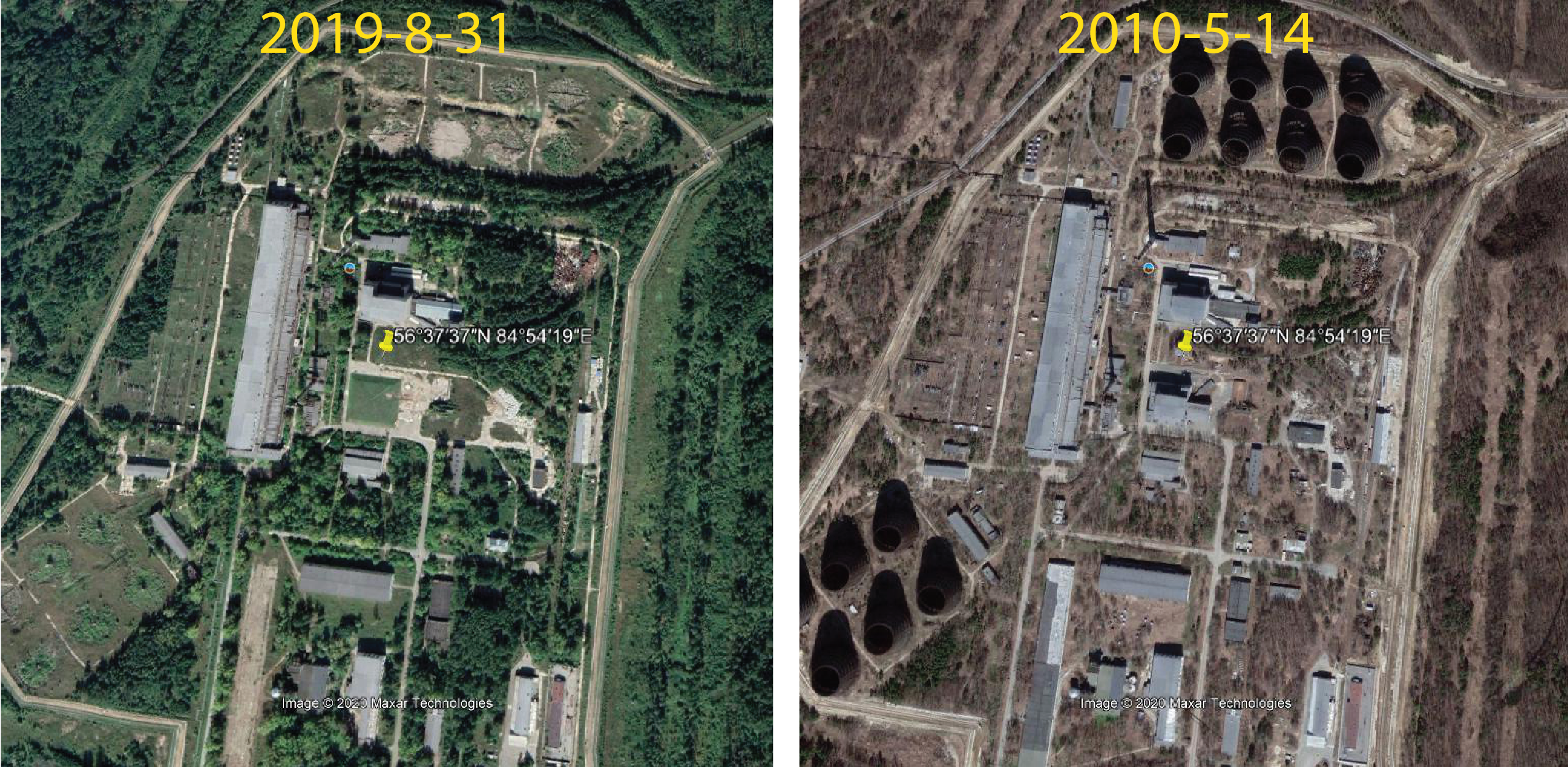
Once again, Yandex reverse image search picks this out as the Sibirskaya Nuclear Power Plant (alas), and Wikipedia gives us the coordinates 56°37′37″N, 84°54′19″E. With that we’re off to Google Earth, where the pin drops us onto a location that doesn’t quite resemble the power plant shown above: there are no cooling towers in sight, but there are a collection of circular concreted areas. A quick return to Wiki tells us that the power plant was decommissioned in 2008, and Google’s historical imagery reveals that the cooling towers were demolished some time between 2010 and 2012.

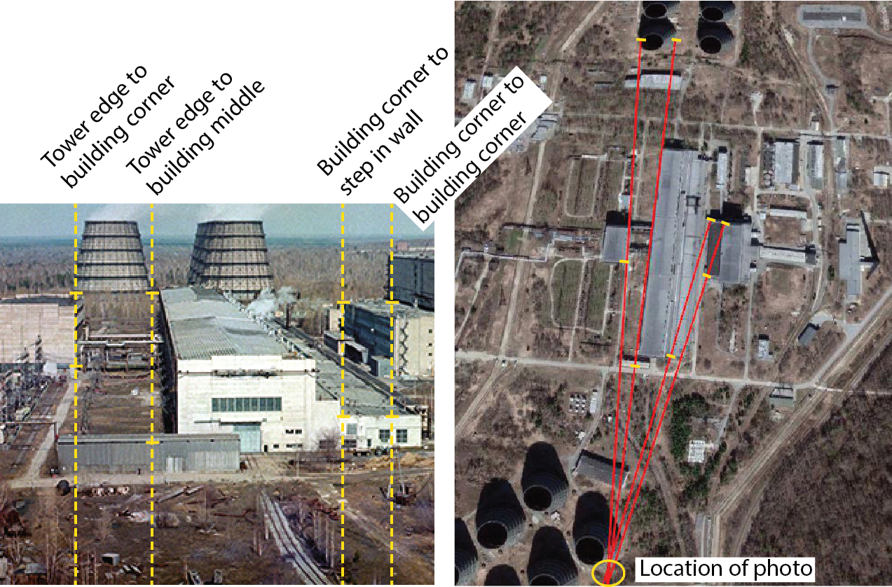
We can now see a nice set of cooling towers, but it’s hard to match this scene to the photograph above. The photo shows a long building aligned to a double row of cooling towers, but the long building visible in this imagery doesn’t align with either of the cooling tower clusters. Looking around the site a little more reveals a second set of buildings about 2 km to the north, and this time the long building lines up very nicely with a set of cooling towers: the photographer is to the south of the complex, looking north.
The many sharply defined features in this photograph over a wide range of depths provide plenty of choice in sighting some angles. Here I’ve chosen four lines linking various features of the buildings that can be identified on Google Earth. Tracing lines through these points suggests that the photograph was taken from somewhere near the easternmost cooling tower of the southern set (location: 56.641911, 84.912230).

My first thought at this point was that the photo was taken from the top floor of the building next to the cooling towers (56.642855, 84.912388), but the angles don’t quite line up. In addition, this shot was taken from quite some height above the roof of the long building but by looking at the shadows we can see that the southern building is no higher than the long building to its north. There are some very tall buildings in that location, though: the cooling towers themselves. A photograph taken from the top of the easternmost cooling tower would fit the sight lines plotted above, and would explain the view from high above the two/three-story main building of the complex. I wonder how difficult it is to climb to the top of a 1950s-vintage Soviet cooling tower?